
District Profile
District Profile
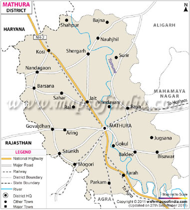
Name of the District : Mathura
Total Geographical Area : 3.32 Lac ha.
No. of Tehsils : 05
(Mathura, Mahawan, Manth, Chhata & Goverdhan)
No. of Administrative blocks : 10
(Mathura, Farah, Mahawan, Baldew, Manth, Raya, Naujheel, Chhata, Nandgaon & Goverdhan)
Total geographical area : 3.32 mha.
Total Cultivated land : 3.28 mha.
Total Irrigated land : 3.11mha.
Agro - Ecological Situation
Mathura falls in South - West - Semi - Arid Zone
AES - 1 (Naujheel, Manth, Raya & Baldew blocks)
AES - 2 (Mathura, Farah, Chaumuha blocks)
AES - 3 (Chhata, Goverdhan & Nandgaon)
Soil Types
Yamuna - Low land/sediment soil - 108419 ha.
Yamuna - Upland soil - 86896 ha.
Yamuna - Leveled soil - 102221ha.
Degraded / Inferior soil - 30998 ha.
Area, Production and Productivity of major crops cultivated in the district :
| S.N. | Crop | Area (ha) | Production (Mt.) | Productivity (Qtl /ha) |
|---|---|---|---|---|
| Kharif (2017) | ||||
| A | Paddy Bajra Til Arhar Maize Cotton Jawar Total (A) |
48723 43472 529 264.7 156 9975 31 103150.7 |
108360 63672 16 24602 445 149625 23 346743 |
29.57 14.65 3.03 12.40 28.51 15.00 7.45 110.61 |
| B | Rabi (2017 - 18) | |||
| Wheat Barley Mustard Gram Pea Total (B) |
183564 5173 51807 41 3 240588 |
796170 16000 115316 64 5 927555 |
42.00 30.94 17.23 15.61 16.67 122.45 |
|
| C | Zaid (2017) | |||
| Moong Urd Vegetables Total (C) |
2600 130 11834 14564 |
5000 380 -5380 |
5.40 2.92 -8.32 |
|
| Total (A + B + C) | 358302.7 | 1279678 | 241.38 |
Major Constraints
- Availability of poor quality irrigation water.(Saline, Alkaline, Oily etc.)
- Non availability of quality inpits. (Seed, Fertilizers etc. in time)
- Heavy weeds infestation in crops.
- Infestation of Pest & Disease.
- Low productivity of Animals.
- Non descript breeds of cattle.